With a population of over 1.1 million and a history of industrial expansion dating back to the 18th century, Birmingham’s subsurface is a complex mix of made ground, old foundations, and buried services. A GPR survey in Birmingham helps engineers map these hidden features without excavation. We use ground penetrating radar to locate voids, rebar, and utility lines before any intrusive investigation. This non‑destructive method is often paired with capacidad de carga tests to verify bearing capacity in filled areas. For projects on brownfield sites, combining GPR with asentamiento differential analysis provides a complete picture of ground stability. The technique reduces risk and saves time when planning new construction or refurbishment in the city centre.
Subsurface mapping with GPR reveals buried infrastructure and voids that standard boreholes miss, reducing redesign costs during construction.
Scope of work in Birmingham
Critical ground factors in Birmingham
The main risk in Birmingham is encountering undocumented underground structures — old canals, cellars, or backfilled quarries — that a standard borehole might miss. Without a GPR survey, hitting a void during piling can cause costly delays or structural damage. Following BS 5930:2015, we recommend a grid‑based GPR scan before any intrusive work on brownfield sites. This is especially relevant in areas like Digbeth and the Jewellery Quarter, where 19th‑century industrial remains are common. Identifying these features early allows the design team to adjust foundation depths or select alternative Improvement methods.
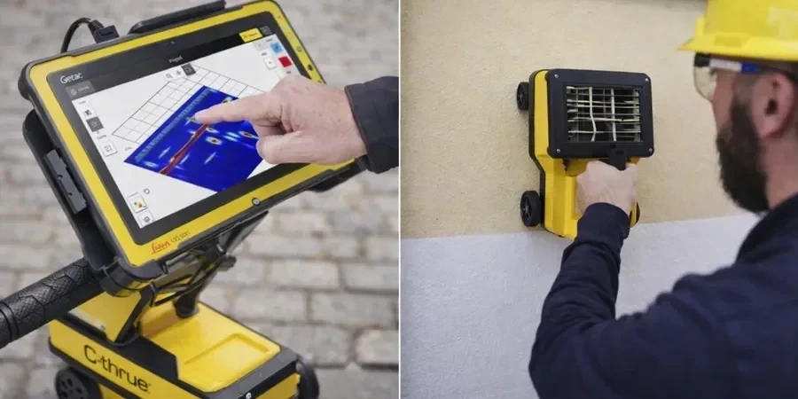
Our services
We offer three focused GPR services tailored to common Birmingham ground conditions:
Utility detection and mapping
Locate buried water pipes, gas lines, cables, and ducts using a 400 MHz antenna. Results are delivered as CAD overlays with depth estimates ±5 cm.
Void and cavity location
Find old mine shafts, collapsed cellars, and solution features using a 200 MHz antenna. Typical detection depth is 4 m in made ground.
Rebar and post‑tension cable scanning
Map reinforcement layout and cover in concrete slabs, walls, and beams using a 1.6 GHz antenna. Useful for core drilling verification.
Q&A
How deep can ground penetrating radar penetrate in Birmingham ground conditions?
In typical Birmingham clay and fill, a 200 MHz antenna reaches 3–4 m depth. In sandier deposits near the River Tame, penetration can extend to 6 m. Higher‑frequency antennas (900 MHz–1.6 GHz) are used for shallow, high‑resolution work to about 1 m depth.
Do you need a GPR survey if you already have borehole logs for a site in Birmingham?
Yes — boreholes provide point data, but GPR gives continuous profiles between boreholes. In Birmingham's brownfield areas, old foundations or voids can exist just metres away from a borehole location. A GPR survey fills those gaps and reduces the chance of unexpected ground conditions during construction.
What is the typical cost of a GPR survey in Birmingham?
The typical cost for a GPR survey in Birmingham ranges from £590 to £1,000 depending on site area, antenna selection, and reporting detail. A small utility detection scan on a 0.5 ha site usually falls around the lower end, while a full cavity search with 200 MHz antenna on 1 ha costs closer to the upper end. We provide a fixed quote after a quick site visit.
Can GPR detect plastic pipes or modern utility ducts?
Yes, but the signal strength depends on the pipe diameter and the surrounding soil. Plastic pipes larger than 50 mm are usually detectable in Birmingham clay. Metal pipes and ducts give a stronger reflection. For small‑diameter plastic pipes in wet clay, we sometimes combine GPR with a cimentaciones superficiales study to improve confidence.