Birmingham’s growth as an industrial powerhouse, particularly during the 18th and 19th centuries, saw extensive excavation and filling of its varied geological strata. The city sits primarily on Triassic Mercia Mudstone, with sandstone ridges and river terrace deposits from the River Rea and Tame. This legacy of modified ground means many existing slopes, from canal cuttings to railway embankments, require careful observation over time. Monthly geotechnical slope monitoring provides the continuous data needed to track subtle movements that could precede a failure, offering engineers a clear picture of stability trends without relying on assumptions from static assessments alone. For deeper understanding of failure mechanisms, this data feeds into a stability analysis to refine safety factors under varying conditions.
Automated inclinometers in Birmingham’s Mercia Mudstone slopes detect mm-scale creep that manual surveys routinely miss, providing early warning of rotational failures.
Scope of work in Birmingham
- Initial baseline survey using differential GPS and fixed benchmarks
- Monthly instrument reading and data transmission via cloud platform
- Threshold-based alerts when movement exceeds 2 mm/month or pore pressure ratios rise above 0.5
Critical ground factors in Birmingham
The West Midlands climate, with annual rainfall averaging 700–800 mm concentrated between October and March, saturates Birmingham’s clay-rich mudstone slopes to the point of reduced effective stress. Cyclical wetting and drying drives progressive fissuring, especially along old cut slopes where stress relief has already reduced shear strength. Monthly monitoring captures these seasonal peaks in pore pressure that shorter programs would miss, allowing engineers to correlate rainfall data with real-time displacement trends. Ignoring these fluctuations in a city with over 200 km of canal embankments and deep railway cuttings increases the likelihood of undetected strain accumulation leading to sudden failure during heavy spring storms.
This service complements our laboratory testing work for a complete project analysis.
Our services
Our Birmingham geotechnical slope monitoring service is structured into three core components, each addressing a critical phase of the observation cycle.
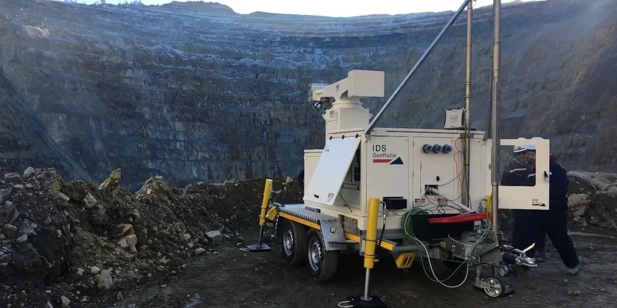
Instrumentation Installation and Baseline Survey
Installation of inclinometer casings, vibrating-wire piezometers, and surface monitoring prisms at predetermined locations along the slope. We establish a baseline survey using static GPS and network adjustment to achieve sub-centimeter accuracy, essential for detecting early movements in Birmingham’s variable ground conditions.
Monthly Data Collection and Remote Monitoring
Each month, field technicians read all instruments using a combination of manual inclinometer probes and automated data loggers. Data is transmitted via cellular network to a secure cloud platform where it is processed and compared against thresholds. Alerts are issued automatically if displacement rates or pore pressures exceed pre-set limits.
Analysis and Reporting with Trend Interpretation
We produce a monthly technical report that includes displacement vectors, pore pressure trends, rainfall correlation, and updated stability analysis. The report compares current readings against the baseline and previous months, identifying acceleration patterns that may indicate impending failure. Recommendations for remediation or increased monitoring frequency are provided when thresholds are approached.
Q&A
What is the typical cost range for monthly geotechnical slope monitoring in Birmingham?
For a standard slope with 3–5 inclinometers and 2–3 piezometers, monthly monitoring typically costs between £350 and £960 per month. This includes instrument reading, data processing, and a written report. Larger slopes with more instruments or remote access challenges may fall at the higher end of this range.
How long should monthly slope monitoring continue before stopping?
Monitoring should continue until at least 12 consecutive months of readings show no accelerating trend and displacement rates remain below 2 mm/month. For slopes with a history of movement or located in high-risk areas near infrastructure, indefinite monitoring is recommended to capture seasonal variations and long-term creep.
What instruments are typically used for monthly slope monitoring?
The primary instruments include in-place inclinometers for subsurface displacement, vibrating-wire piezometers for pore pressure, and optical prisms or GNSS receivers for surface movement. Automated data loggers are installed at the site to collect readings continuously, with monthly visits for manual verification and maintenance.
Can monthly monitoring detect slope failures before they happen?
Yes, monthly readings can detect acceleration patterns, such as increasing displacement rates or rising pore pressures, that precede a failure by weeks or months. The key is establishing a reliable baseline and applying threshold-based alerts. In Birmingham's mudstone slopes, early warning times of 2–6 weeks have been achieved for rotational failures.